Legally binding boundary surveys and cadastral mapping for property registration, land titling, and ownership protection across Rwanda.
Cadastral surveys are the legal foundation of land ownership. Megisha Landmark delivers accurate, court-admissible boundary surveys and cadastral mapping services that protect your investment and satisfy Rwanda Land Management and Use Authority (RLMUA) requirements.
Whether you are subdividing a family parcel, resolving a boundary dispute, or registering a new title, our licensed surveyors follow the Land Law and Technical Guidelines to ensure your survey is accepted first time, every time.
We serve individuals, developers, government agencies, and NGOs throughout Rwanda — from urban Kigali plots to rural land in every province.
Comprehensive boundary and property surveying solutions from first stake to final title
Physical identification and marking of property boundaries using permanent beacons in compliance with national cadastral standards.
Subdivision of parcels into smaller plots with approved survey plans, coordinates, and certificates ready for RLMUA registration.
Merging adjacent parcels into a single registered plot, with updated cadastral plans and legal documentation.
Independent expert surveys to resolve boundary conflicts, with impartial reports suitable for mediation and court proceedings.
Full preparation of survey plans, area calculations, and technical files required for first-time and updated land title registration.
High-density cadastral mapping for urban renewal, expropriation projects, and master plan implementation in Kigali and secondary cities.
We combine technical excellence with local regulatory knowledge to deliver surveys that are accepted without delays
All surveyors are licensed by the Rwanda Inspectorate and fully accredited to conduct official cadastral work.
Efficient field and office processes mean your survey plan and documents are ready faster — reducing delays in your property transaction.
Every survey strictly follows the Rwanda Land Law (Law No. 43/2013) and RLMUA technical guidelines for guaranteed acceptance.
We guide you through the entire process — from initial consultation to final registration — handling all technical steps on your behalf.
Simple, transparent, and professionally managed from start to finish
We review your existing title deed, sketch plan, and any historical survey data to understand your parcel history.
Adjacent landowners are notified of the survey date as required by law, ensuring transparent and disputable results.
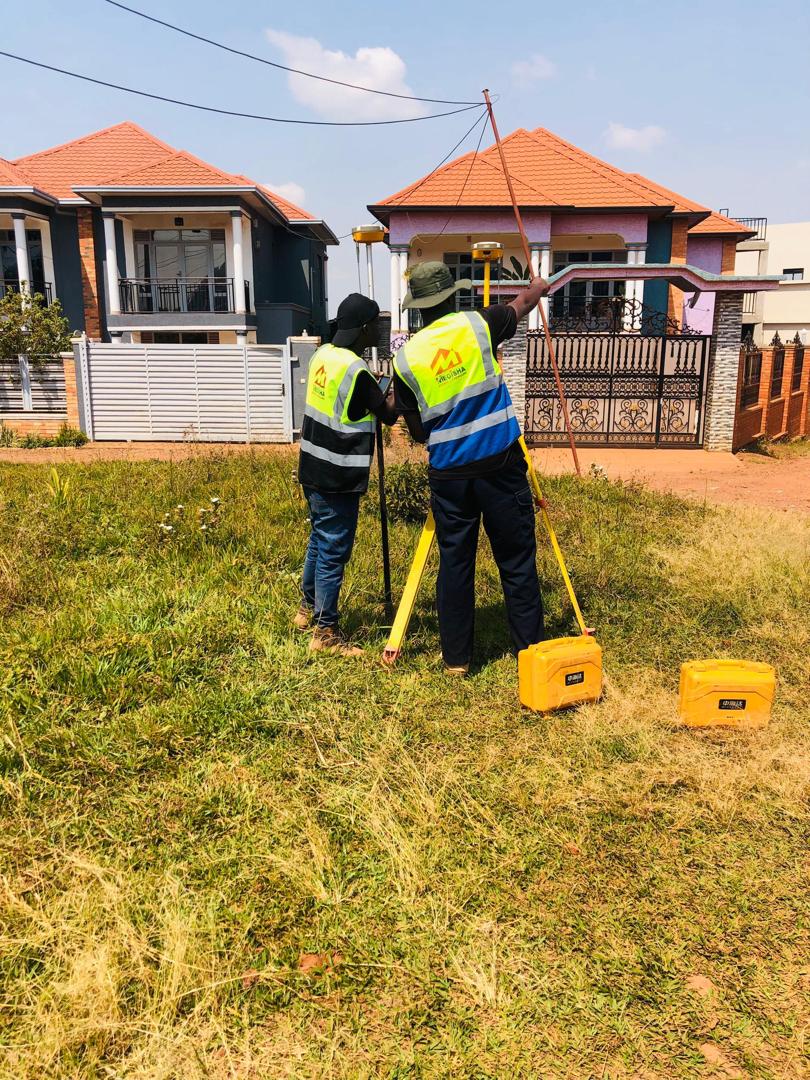
Boundary corners are located, measured, and beaconed using calibrated GNSS equipment tied to the national geodetic network.
A full cadastral plan showing dimensions, area, coordinates, and adjoining parcels is produced to RLMUA standard format.
We submit your approved survey plan to RLMUA and follow up until your title deed or registration is confirmed.